Birmingham City Council
Tree preservation zone
There is a problem
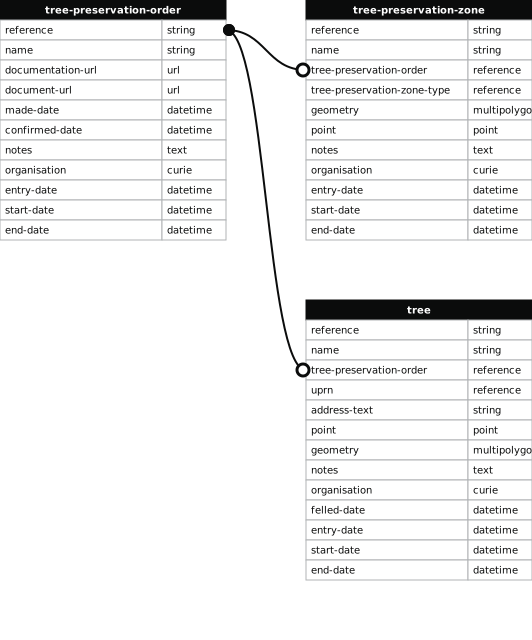
- 1000 entries with tree-preservation-order field must match the reference field in the tree preservation order dataset
THE BIRMINGHAM (LAND AT 91-93 REDNAL ROAD, KING'S NORTON) TPO 1987
- reference
- 442
- name
- THE BIRMINGHAM (LAND AT 91-93 REDNAL ROAD, KING'S NORTON) TPO 1987
- tree-preservation-order
- TPO 442
- tree-preservation-zone-type
- area
- geometry
- MULTIPOLYGON (((-1.936237 52.403639,-1.936016 52.403363,-1.935858 52.403126,-1.935761 52.402977,-1.935729 52.402933,-1.935721 52.402916,-1.935705 52.402890,-1.935700 52.402876,-1.935384 52.403043,-1.935250 52.403111,-1.934776 52.403360,-1.935060 52.403932,-1.935125 52.404066,-1.934878 52.404141,-1.934940 52.404206,-1.935033 52.404180,-1.935220 52.404132,-1.935306 52.404106,-1.935443 52.404060,-1.935480 52.404046,-1.935201 52.403436,-1.935525 52.403289,-1.935652 52.403524,-1.935852 52.403872,-1.935942 52.403826,-1.936025 52.403779,-1.936061 52.403756,-1.936173 52.403678,-1.936237 52.403639)))
- point
- POINT (-1.935458 52.403501)
- notes
- The shaded area represents those properties which fall within the outline of a Tree Preservation Order. To precisely identify trees protected by the Order, you can request a copy of the tree preservation order at the following link.
- entry-date
- 2026-10-15
- start-date
- end-date
How to fix this issue
Your data is missing a tree-preservation-order.
The tree preservation zone guidance explains how to fix the issue:
tree-preservation-order
The reference for the tree preservation order that covers this zone.
How to improve Birmingham City Council’s data
- Fix the errors indicated
- Use the check service to make sure the data meets the standard
- Publish the updated data on the endpoint URL